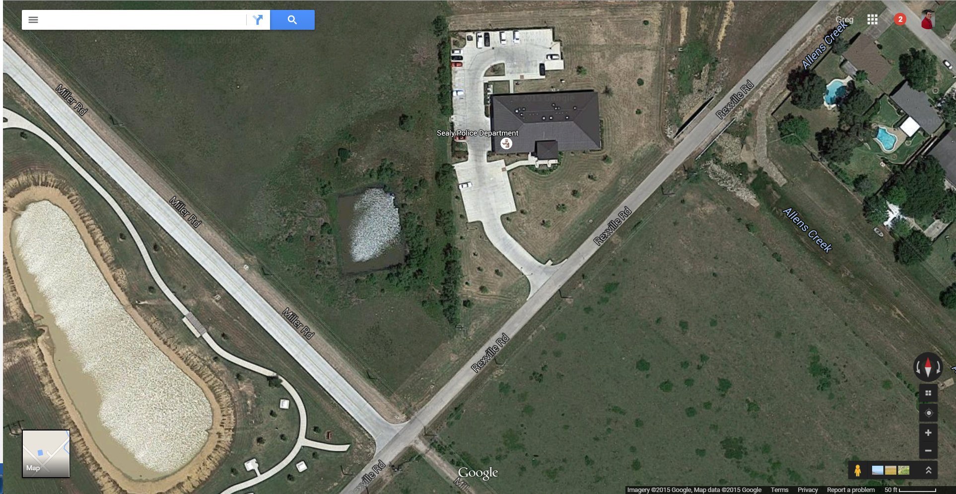
![Sealy City Council Decides On Action Plan To Prevent Further Flooding of Sealy PD Station [VIDEO]](https://austincountynewsonline.com/wp-content/uploads/2015/08/sealy-pd-aerial-view.jpg)
At the June 23rd Sealy City Council meeting the firm who designed the Sealy Police Department building gave an overview report to the council. The report concerned the flooding that took place during Tropical Storm Bill on June 18th. The more than 9 inches that was dumped on the department had the Sealy PD scrambling to move police vehicles out of the way of the rising flood water running through the parking lot. Bob Schmidt’s original presentation to the council explained that the floods were due to such an excessive amount of water in such a short amount of time.
In last Tuesday’s City Council meeting he gave more in depth explanations of what happened after doing extensive research and field work on the flooding issue. The problems were due to the waters being about 1.1 feet above the 100 year flood plain. Though there was extensive rain that fell in a short amount of time the primary problem was the complete saturation of the ground and its inability to soak up any more water. This over saturation caused the large amount of rainfall in the short amount of time to cause the excessive overflow of water that threatened to flood the police vehicles. In normal conditions, grassy soil like what is around the police station would have soaked up to a certain amount of the water by the ground, which in this case did not happen.
The police department is 2.55 feet above the 100 year flood plain level which kept the building itself almost a foot and a half above the water level that night. When the site was designed, the police station was built in a subtle valley with a retention pond being constructed farther up to allow for the water to be caught and be slowly released to drain away. However, the construction group that dug the pond did not dig it to the proper specification and made it too small for the amount of water that fell. The police station was designed, in the event that more water came through than the ditch and drainage could handle the overflow through the police station parking lot and be shunted away down Allen’s Creek before it could flood the police station structure and do any damage. In that capacity, the engineering designs features worked perfectly. The water did exactly as the engineers had designed it to do but, the designs were not designed to handle that much water. The opinion of the engineering firm is to construct a ditch along the upstream edge of the police department site and carry it to the north edge site then through an open ditch to Allen’s Creek.
The firm explained that the next step in solving the problem was to have topographical surveys performed to give more accurate figures because the previous topographical survey used during the construction of the police station was performed before the dirt work and building structure were present. This additional information will be vital for the firm to construct proper models and solutions for the city to take action on. The Sealy City Council voted unanimously to approve having a new topographical survey performed and also to check with property owners should any additional digging need to be done that might cause some imminent domain issues. This is, of course, a general overview of the matter. For complete details on the matter and the ensuing discussion we encourage you to watch the 37 minute exchange between the engineering firm and the Sealy City Council. We are providing an aerial view of the area under discussion, simply click on the image to get a larger view of the area.
![Candidate Forum Held for Wallis City Council Race Ahead of 2024 General Election [VIDEO]](https://i2.wp.com/austincountynewsonline.com/wp-content/uploads/2024/04/Wallis-City-Sign.jpg?resize=440,264)


